 OSU Pytheas - Data Catalog
IMBE UMR 6372 CNRS
Type of resources
Available actions
Topics
INSPIRE themes
Keywords
Contact for the resource
Provided by
Years
Formats
Representation types
Update frequencies
status
Scale
-
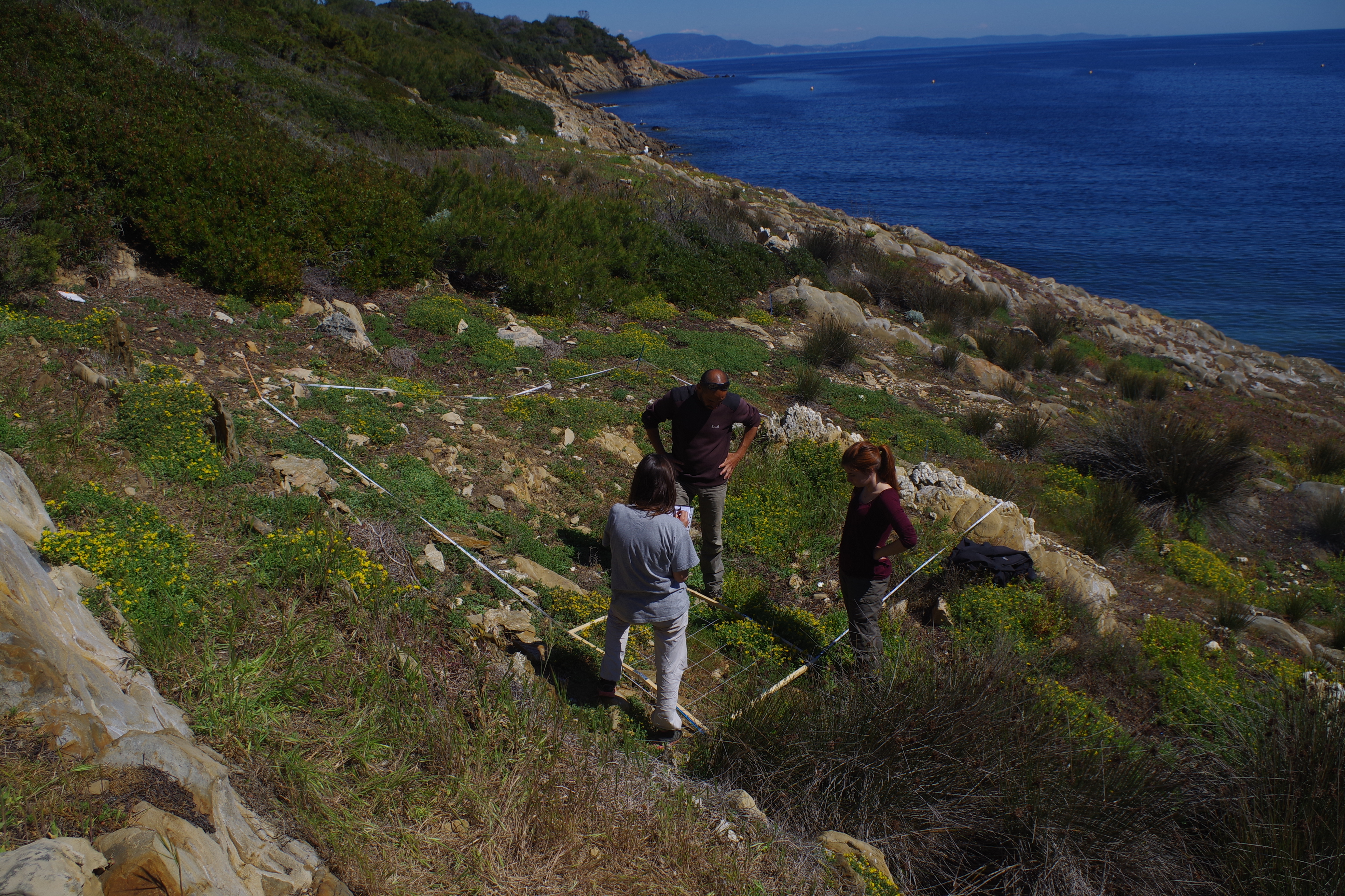
L’île de Bagaud, réserve intégrale du Parc National de Port Cros (PNPC), fait actuellement l‘objet d’un programme décennal de restauration écologique en vue de la préservation de son patrimoine naturel. Cette restauration consiste à contrôler deux espèces exotiques envahissantes : le rat noir (Rattus rattus) et la griffe de sorcière (Carpobrotus sp.). Débuté en 2010, ce programme permet l’étude de plusieurs groupes taxonomiques avant (2010-2011) et après contrôle (2013-2019) : (1) la flore, (2) les arthropodes épigés et les insectes volants, (3) les squamates, (4) les oiseaux terrestres nicheurs et (5) les oiseaux marins nicheurs. Ce projet fédère une large communauté d’acteurs académiques et non-académiques autour d’un objectif commun : contrôler et si possible éradiquer les espèces invasives de la réserve intégrale et suivre la résilience des groupes taxonomiques cités ci-dessus. Partenaires pour le suivi et l’analyse des données : IMBE, PNPC, CBNMed, association Reptil’Var, association DREAM et LPO. Autres partenaires : PIM, INRA, Conservatoire du Littoral, Domaine du Rayol, Naturoscope, UE, Natura2000, TLV, Région Sud, Naturalia Consultants en Environnement.
-
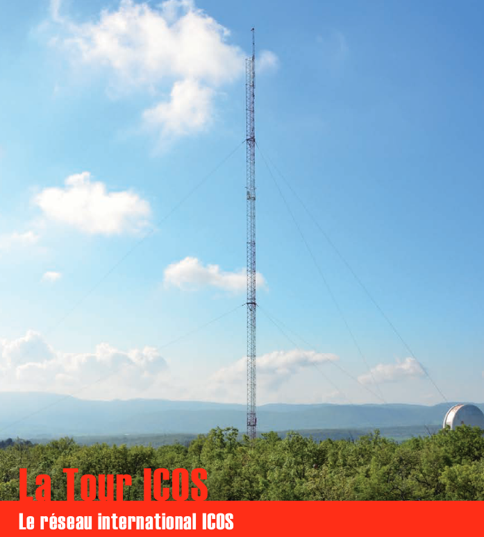
Une infrastructure de recherche européenne de mesure des concentrations atmosphériques des gaz à effet de serre et des flux de carbone sur les écosystèmes et l’océan. La tour ICOS (pour Integrated Carbon Observation System) installée à l'Observatoire de Haute Provence (OHP), haute de 100 m est une antenne régionale du dispositif permettant d’étudier la place de la forêt méditerranéenne dans le bilan de carbone. Elle est équipée d’instruments à trois niveaux (10, 50, 100 m). Le réseau est doté de 3 types de stations réparties sur le territoire : continentales, côtières et de montagne. Chacune de ces stations mesure les paramètres suivants : * température, direction et vitesse du vent, pression atmosphérique, humidité * CO2, CH4, CO, H2O * hauteur de couche limite atmosphérique (lidar) Les objectifs scientifiques de ce programme européen sont de : * tracer les flux de carbone en Europe et dans les régions adjacentes par observation des écosystèmes, de l'atmosphère et des océans à travers des réseaux intégrés, * fournir les observations à long terme nécessaires pour comprendre l'état présent et prévoir le comportement du carbone global et des émissions des gaz à effet de serre, * surveiller et évaluer l'efficacité de la séquestration du carbone et/ou de la réduction des émissions de gaz à effet de serre sur la composition globale de l'atmosphère, en prenant en compte les sources et les puits par région géographique et par secteur d'activité. L'infrastructure ICOS permet d'accueillir des chercheurs pour des campagnes de recherches
-

Agricultural yields under climate change (19 GCMs) for 2,3,4 and 5°C warming, with and without CO2-fertilization effect.
-

Assuming the huge progress achieved in public participatory geographic information system (PPGIS) techniques and its current research gaps, this study aims to explore differences in the perception of spatial distribution of ecosystem services supply and demand between different stakeholders through collaborative mapping. In this case the stakeholders selected included low influence stakeholders (with a high degree of interest on the ecosystem services' state and with a low influence in environmental management). Workshops took place in June 2013 in two regions of Andalusia; overall 29 participants were involved. Food from agriculture and livestock were mapped.
-

Assuming the huge progress achieved in public participatory geographic information system (PPGIS) techniques and its current research gaps, this study aims to explore differences in the perception of spatial distribution of ecosystem services supply and demand between different stakeholders through collaborative mapping. In this case the stakeholders selected included low influence stakeholders (with a high degree of interest on the ecosystem services' state and with a low influence in environmental management). Workshops took place in June 2013 in two regions of Andalusia; overall 29 participants were involved. Two ecosystem services were mapped (freshwater and energy).
-

Gross and net irrigation requirements under climate change (19 GCMs) for 2,3,4 and 5°C warming, with and without CO2-fertilization effect, for 3 scenarios of irrigation technology.
-

Assuming the huge progress achieved in public participatory geographic information system (PPGIS) techniques and its current research gaps, this study aims to explore differences in the perception of spatial distribution of ecosystem services supply and demand between different stakeholders through collaborative mapping. In this case the stakeholders selected included low influence stakeholders (with a high degree of interest on the ecosystem services' state and with a low influence in environmental management). Workshops took place in June 2013 in two regions of Andalusia; overall 29 participants were involved. Three ecosystem services were mapped (recreative hunting, nature tourism and relaxing value).
-

Assuming the huge progress achieved in public participatory geographic information system (PPGIS) techniques and its current research gaps, this study aims to explore differences in the perception of spatial distribution of ecosystem services supply and demand between different stakeholders through collaborative mapping. In this case the stakeholders selected included low influence stakeholders (with a high degree of interest on the ecosystem services' state and with a low influence in environmental management). Workshops took place in June 2013 in two regions of Andalusia; overall 29 participants were involved. Three ecosystem services were mapped (erosion control, water depuration and climate regulation).
-

Assuming the huge progress achieved in public participatory geographic information system (PPGIS) techniques and its current research gaps, this study aims to explore differences in the perception of spatial distribution of ecosystem services supply and demand between different stakeholders through collaborative mapping. In this case the stakeholders selected included low influence stakeholders (with a high degree of interest on the ecosystem services' state and with a low influence in environmental management). Workshops took place in June 2013 in two regions of Andalusia; overall 29 participants were involved. Food from agriculture and livestock were mapped.
-

Assuming the huge progress achieved in public participatory geographic information system (PPGIS) techniques and its current research gaps, this study aims to explore differences in the perception of spatial distribution of ecosystem services supply and demand between different stakeholders through collaborative mapping. In this case the stakeholders selected included high influence stakeholder (with a high degree of interest on the ecosystem services' state and with an important influence into the environmental decision making process). Workshops took place in June 2013 in two regions of Andalusia; overall 29 participants were involved. Food from agriculture was mapped.